Google Maps Can Make You a Better Fisherman
by
Rick Lawrence, August 09, 2020
A Google map’s isn’t just to find your way to Grandma’s house anymore. For many years I have been using Google maps to find new fishing spots. You can learn a lot about a lake or river by just studying it in close detail on Google maps. You can find sunken islands and logs, rock plies you never knew were there and my favorite weedlines, as well as down trees, but in the last few years I have been using for a lot more. I use 2 different Google map programs on 2 different devices. I use Google Earth pro for my PC and Google maps on my smart phone .
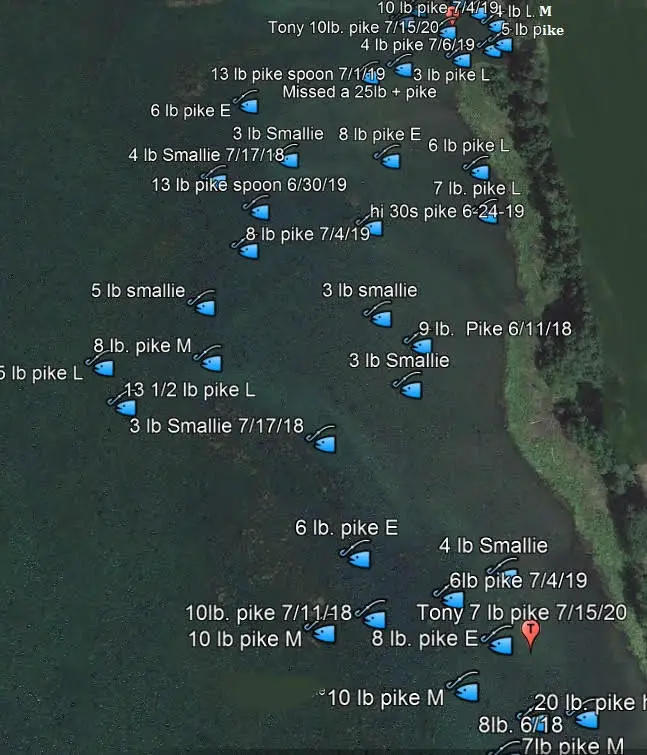
On Google Earth Pro for desktops which is a free download. I use it as a way to keep records of all my fish catches by adding a place marking each fish at the end of each fishing trip with the exact location, the day caught, what fish species it was and how big and what lure it was caught on. That way you have a permanent record of your fish and if I need any info on any spot I have fished before I just have to look it up. This is a wealth of knowledge that over the years you will see patterns develop that you didn’t see at the time. As you can see in the photo above I mark each fish with a fish symbol from the drop down pins and in the notes that Google Earth pro has you can give detailed info about the catch that is revealed when you put your curser on that mark. This info is private and only you can see what’s on your Google Earth images, but if you do want to share something it is easy to open it and do a screen shot and share it with somebody else. Google Earth pro also has icons on the top that you can email info.
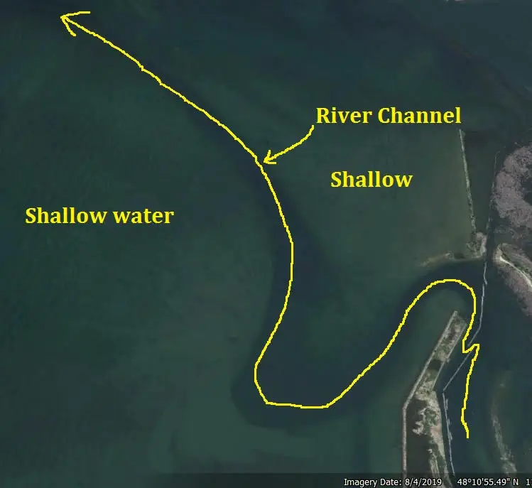
I also use Google maps on my phone to navigate in my boat at nite to help find the boat launch or if I’m trying to follow a channel that is not marked. I know a lot of new fish finders can do some of this as well, but not everyone has a good GPS mapping program on their boat but we almost all have a smart phone. I know of a spot that you have to fallow the river channel out about a mile to get into safe water, but you can’t tell the shallow water from the deeper water by looking out across the lake and the sonar charts of the area are so inaccurate they are useless. So I just turn on maps on my phone and follow the channel out to deep water with the aerial photo view. The channel is clearly visible as a dark green area that I fallowed with the yellow line in the photo showing the deeper water. Being able to use your smart phone to navigate can really save on props as well. This has saved my butt more than once when trying to find my way back to the boat launch.
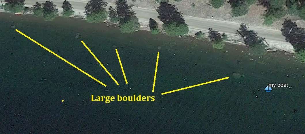
Another way I use Google maps with my phone is to position my boat as I approach cover that I know is coming up, but can’t see it yet. This is great then I fish the lake and I’m coming up on a big boulder as I can tell where the boulder is before I get to it. That way I can fish from a little farther away and not spook the fish, but still know where the rock I’m fishing is at without having to see it.
I also use it for measuring distances and creating all kinds of waypoints from hazards in the water, to boat launch locations, to places I want to go check out sometime in the future. You can also look at the historical images on Google Earth pro to look back in time that can show you a lot of info as it can show when the lake had high water levels or low water levels. If you can find a low water photo this can be very interesting and you can find all kinds of structure that is exposed that you might have never known were there. This can also show areas where the water stays clear even though the main lake or river is muddy. This can be very useful to find spots that don’t get mudded up in the spring as bass and pike like clear water if they can find it.
You can also make and save paths to navigate by. You just click on the path icon at the top of the page and you can make and save a path that you can fallow or share with someone else.
There is even a icon that can show you what areas are in shade for the time of day you are fishing. If it’s a hot day and you want to fish the shady side of the lake you can use this feature to find a shady spot for that time of day.
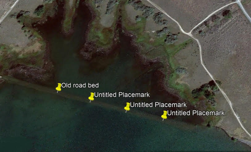
Another cool feature is you can not only mark all the waypoints like structure or hazards and places you want to check out on Google Earth pro like this road bed, but you can also save those to an SD card that you can put in your Humminbird fishfinder. This is a little complicated but this video explains how to do it very well.
https://www.youtube.com/watch?v=Ze2YJ2WOQSE
That way you will know exactly where the piece of structure you marked is at on your favorite lake.
Comments
Why is this comment inappropriate?
Delete this comment? Provide reason.