Anglinarcher
8/22/2011 5:20:00 PMThere is no map that shows the spots. I have them marked on my GPS on the boat, but not on any map.
For the most part, if you stay out at least 200 yards when at speed, you will be fine. If you then reduce speed until you learn the lake, you will be fine.
I learned the lake this time of year by fishing for Bass and Crappie on Rock, tossing cranks and jigs to the edges. It is slow, but if you have a fish finder and take your time, soon you will have the lake figured out. The lake is only about 8 miles long, and you can cover about 4 or 5 miles a day that way, so in about 5 or 6 trips, you will also know the danger spots. Well, until another rock slides drops another danger in. LOL

rwl
8/22/2011 7:13:00 PMI don't know the danger spots, my boat is neither fast nor does it have much of a draft.
Are you catching any trout out there lately? What does the water temp and clarity look like?
Are you catching any trout out there lately? What does the water temp and clarity look like?
Anglinarcher
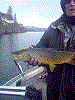
8/23/2011 3:59:00 PMI don't fish Rock for Trout after the water temps climb above 60 degrees, and it fishes pretty tough after 55 degrees. I have done well at night on Rock for trout during the summer, but then again, I have the GPS with waypoints.
Look for me in November or December at Rock, if I am not on Roosevelt for Walleye.
Look for me in November or December at Rock, if I am not on Roosevelt for Walleye.

Ghoti
8/23/2011 9:44:00 PMFor the sake of safety, it's pretty easy to point out some of the most obvious trouble spots.
That being about 1/4 of the way up the lake on both sides, with the east side being worse. Another "gotcha" spot is some large boulders in the water near the beach area (about halfway up, on the east side).
In fact, if you zoom in close using Google Earth, you can actually see many of these. The photo is clearly taken in the late summer when the water is low and so it reveals many of the shallow piles, but NOT ALL!
Again, as AA describes, if you want to run the lake at full throttle just stay in the middle, and then always be very alert when approaching the shoreline.
Good luck!